Format A
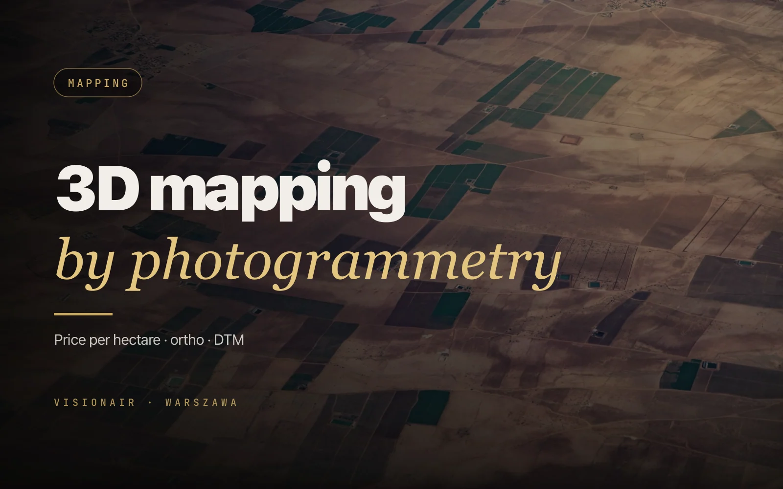
PL-2000 orthophoto
Georeferenced mosaic in the Polish state grid, 1-2 cm/pixel. GeoTIFF + PDF.
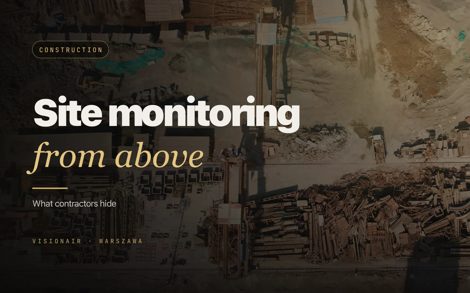
RTK 2-3 cm accuracy, PL-2000 orthophotos, progress timelapse, PDF reports for the bank and investor. Monthly subscriptions for developers. EASA, insured, CTR permits on us.
The bank wants a progress report, the investor wants an orthophoto, the site manager wants a timelapse. One drone visit produces all three.
We fly drones with Real-Time Kinematic (RTK), 2-3 cm horizontal accuracy. Precise enough to measure spoil heap volume or excavation cut — no surveyor needed.
Bank experience: PDF reports comparing schedule vs. actual, GPS markers, dates, next-stage forecast. NDA and you're on the trusted-vendor list.
Every drone visit produces three deliverables: orthophoto, 3D model, bank-grade PDF report.
Georeferenced mosaic in the Polish state grid, 1-2 cm/pixel. GeoTIFF + PDF.
Textured mesh, export to.obj /.fbx /.las. Imports into BIM / Revit / AutoCAD.
Spoil heaps, cuts, stockpiles — automated volume, PDF with m³.
Same position, same hour — 12-30 months edited into a 60-second investor film.
Standard format accepted by Polish banks, schedule comparison, GPS markers.
Optional — thermal of insulation, roofs, district heating bundled with the survey.
Typical client: developer with 2-5 active investments. Second: general contractor. Third: financing bank.
Every project is unique — pricing is built around the brief. Sketch your idea in two lines and we’ll call back within 24 hours with a concrete offer.
The first visit is longer — we set GCPs and the flight plan. Subsequent visits are a repeatable procedure.
First visit: 6-12 Ground Control Points, RTK calibration to local datum, baseline photos.
Same flight plan, same hour — critical for timelapse and comparison. 60-90 minutes on site.
Mosaic + 3D in Pix4D / Agisoft, export to GeoTIFF,.las,.obj.
Month-over-month delta, % progress, volume measurements, flags for the bank.
Cloud delivery (Frame.io or your OneDrive), PDF report via email, online preview.
Selected frames from recent shoots — Warsaw business districts, the Old Town, palaces, skylines, winter markets and travel landscapes. All captured on our DJI fleet and graded in studio.
Real commercial shoots — from a café to premium real estate and an auto service. Tap any case to watch the video.
Full technical docs, liability policies, RTK certificates — PDF on request.
2-3 cm horizontal, 3-5 cm vertical under Open Sky. Enough for progress reporting, spoil heap volume, deviation detection. Surveyor-grade < 1 cm — we add GCPs.
Yes. Regular work with PKO BP, mBank, Pekao, Millennium. Report format aligns with tranche-release requirements, includes GPS markers, dates, qualified operator signature.
Yes — standard deliverable. We scan the heap, compare to the previous scan, deliver m³ with ± 1-3% error. Good enough for mass balance.
Pick a day (usually first Monday), we show up on our own, fly, report. Monthly VAT invoice, two investments can share one invoice — 10% discount.
We check whether the airspace is open to us and file the request 24-72 hours in advance. The cost of the application is already included in the offer - no after-the-fact surcharges.
Within 48 hours we run a comparative control flight free of charge. If the error remains above 5 cm under Open Sky - we refund the full cost of the monthly visit. Across 3 years this has happened once (magnetic anomaly near a substation); we re-flew the next day and the report was delivered on time.
An OC (third-party liability insurance) policy of 5 million PLN (approximately 1.1 million EUR) covers injury to a person, damage to a contractor's equipment (crane, loader, mobile lift), and damage to materials and finished masonry. The pilot also carries individual professional liability insurance via ULC (Urząd Lotnictwa Cywilnego, Polish Civil Aviation Authority). For sites > 50 million PLN we extend the policy to 10 million PLN for an additional on request.
All data - on Polish servers at OVH Polska (RODO/GDPR-compliant) or on your AWS Frankfurt S3 bucket on request. Access is limited to two people on our side (pilot + post-processor), MFA is mandatory, and access logs are provided on request. After the contract ends - data is deleted at the client's choice (immediate, 90, 180 or 365 days).
First visit with RTK calibration to local datum takes 2-4 hours. Monthly visits drop to 90 minutes.
Drop your contact — we reply within 30 minutes during business hours. Initial quote within 24 h, no strings attached.